


Île-de-France Mobilités
4.7238.00 Reviews
App Specs
- Version
- Varies with Device
- Updated On
- License
- Free
- Downloads
- 5,000,000+
- Developer
- Île-de-France Mobilités
- Categories
- Maps & Navigation
- Platform
- Android, iOS
Screenshots

 Analysis by AppCompare
When I need to make a trip across the Paris region, the most useful question is often not simply which line to take, but whether the route is still a good choice right now. That is where Île-de-France Mobilités earns its place on my phone: it brings journey planning and traffic information together, so I can check a route and reconsider it when travel conditions change. It is a free maps and navigation app from Île-de-France Mobilités, built for a region where a straightforward trip can involve several transport options.
Why live travel information matters
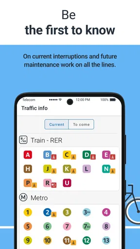
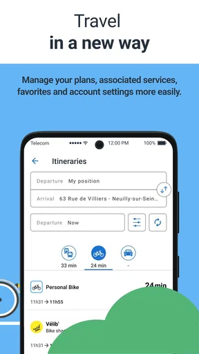
A route planner is most valuable when it helps with decisions, not just directions. I use the app to look up a destination, compare possible journeys, and then check traffic information before committing to one. That last step matters on a day when a delay or disruption could make a familiar route less practical. Rather than treating the first result as a promise, I see it as a plan to verify against current conditions.
This is especially helpful when I have a connection to make or need to arrive at a particular time. If the journey looks uncertain, I can consider another option before I set off instead of discovering a problem halfway through. The app is not a guarantee that every change will be reflected immediately, so I still leave room for judgement, but having itinerary planning and traffic updates in the same place makes that check easier.
Making a plan that fits the day
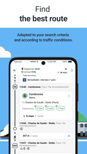
For an everyday trip, I would start by entering the destination and comparing the suggested itineraries rather than choosing the first one automatically. A route that is quickest on screen may not be the one I want if I am carrying bags, travelling with a child, or trying to limit walking. The ability to consider different journey preferences is useful because it turns route planning into a practical choice, not just a race against the clock.
For example, imagine leaving a station after work to meet someone elsewhere in the region. I can check the route before walking to a platform, look at the alternatives, and pay attention to traffic information if the journey appears disrupted. If I use a route often, saving it can make a later check quicker. My tip is to review the whole journey before setting off, including the parts between transport legs; a route that looks convenient at first glance may involve more walking or a tighter connection than I would choose on a relaxed day.
Tickets are useful, but plan the practical details
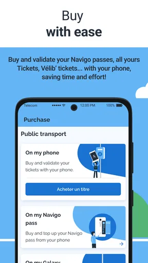
The app also includes ticket purchasing, which can make a trip simpler when I would rather sort out travel on my phone than stop to buy a paper ticket. Having journey information and ticket access together is convenient, particularly when I am planning while already on the move. I would still make sure I understand which ticket or pass suits the specific journey before paying, rather than assuming one purchase covers every trip I might take.
There is a small but important trade-off to phone-based tickets: I need my phone available when travelling. I make a point of checking that I can access what I bought before heading into a busy station, rather than waiting until I am at a gate or being asked to show it. That habit is useful even when everything usually works smoothly, because a ticket on a device is only convenient if the device is ready when I need it.
Worth Reading Before You Choose

Baby Panda World Brings Quick Play to Modern Phones, but Its Game Library Feels Busy

ESPN’s Live Game View Makes Following Close Games Easier

QuizzLand Review: A Good Fit for Short Trivia Breaks, Not Every Player

Basketball Stars: Multiplayer Is Fast, but Can It Recover When Matches Go Wrong?

WEBTOON Turns Phone Updates Into a Better Reading Routine

Link to Windows Runs on Shared Habits, Not Social Feeds
Where it fits among travel apps
Compared with using a general map app alone, Île-de-France Mobilités is more focused on regional public transport and brings ticket buying into the same travel routine. A general maps app may be a better fit when I am mainly walking, driving, or looking for places beyond transport. For planning journeys around the Île-de-France network, though, a regional transport app is the more natural starting point: it keeps the task centred on routes, service conditions, and travel purchases rather than mixing them with unrelated map functions.
I would not rely on any single app as an unquestionable authority during a disruption. If a journey is time-critical, checking the available alternatives and allowing extra time is sensible. Live information is most useful as a decision aid: it helps me notice when I should rethink the plan, but I still need to choose a route that suits the real circumstances of my day.
Getting Started with Île-de-France Mobilités
First things first, downloading the app is a breeze. It's available on both Android and iOS, and it’s free, which is always a plus. Once you’ve got it on your device, you’ll need to create an account. Don’t worry, it’s a quick process and you’ll be up and running in no time.
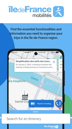
The interface is super intuitive. The main screen greets you with a search bar where you can enter your destination. There are also quick links to find the nearest stations and stops, which is incredibly handy when you’re in a rush. The app supports multiple languages, so even if your French is a bit rusty, you won’t have any trouble navigating through.
Features Galore
One of the standout features of Île-de-France Mobilités is the real-time updates. Whether it’s a delay or a reroute, the app keeps you in the loop. I found this particularly useful during rush hour when things can get a bit chaotic. You can also save your favorite routes, so if you’re a creature of habit like me, this will save you a ton of time.
The app also offers different journey options. You can choose the fastest route, the route with the least walking, or even a route that avoids stairs. This level of personalization is something I truly appreciate, especially when you’re lugging around a suitcase or stroller.
Tickets and Passes
Now, let’s talk about tickets. Gone are the days of fumbling around with paper tickets or trying to top up your Navigo card. With the app, you can purchase tickets directly and have them on your phone. It’s as simple as selecting your ticket type, paying with your preferred method, and voilà, your ticket is ready to go. The app supports various payment options, including credit cards and even PayPal.
Additionally, if you’re a frequent traveler, you can buy passes that cover multiple journeys. This is not only convenient but also cost-effective. The app keeps track of your purchases, so you’ll never lose a ticket again. Just make sure your phone is charged because you’ll need to show the ticket on your screen when requested.
What I Love About It
Honestly, the Île-de-France Mobilités app has made my life so much easier. It’s like having a personal travel assistant in my pocket. The real-time alerts are lifesavers, especially when unexpected changes occur. Plus, the journey planner is incredibly detailed, providing multiple options tailored to your preferences.
Another thing that deserves a shoutout is the app's sleek design. It’s clean, easy to navigate, and doesn’t bombard you with unnecessary information. Everything you need is right there, at your fingertips.
Room for Improvement?
While I’ve been singing its praises, no app is perfect. Occasionally, the GPS can be a bit off, showing your location slightly behind. It’s not a dealbreaker, but something to be aware of. Also, during peak times, the app can slow down a bit, probably due to high traffic.
Another minor gripe is that the app doesn’t always update instantly when you switch data plans or networks. It’s a small hiccup, but if you’re in a hurry, it can be a tad annoying.
Overall, the benefits far outweigh these minor issues. The developers seem to be constantly updating the app, ironing out bugs, and adding features, which is always a good sign.
Final Thoughts
So, would I recommend the Île-de-France Mobilités app? Absolutely. Whether you’re a local or just visiting, it’s an essential tool for navigating the city’s transport system with ease. The convenience of having everything from timetables to tickets in one app is unmatched.
So, next time you’re heading to Paris or its surrounding areas, do yourself a favor and download this app. It might just be the key to a smoother, more enjoyable travel experience. Happy travels!
Who will get the most from it?
I think the strongest fit is someone who regularly travels around Île-de-France and wants one place to check a route, look at service conditions, and handle a ticket purchase. The app has an average rating of 4.6 from around 105,000 ratings and has been installed over 5 million times, which suggests a broad audience, though those figures do not tell me whether it will suit every traveller’s habits.
Visitors can benefit too, especially if they would rather plan a regional public-transport trip than piece together several sources. The Everyone age rating makes it suitable for a general audience, but a less confident traveller may still want to check a route calmly before leaving rather than trying to learn the interface while rushing through a station. I would suggest saving familiar journeys once they are set up, then using the planner for unfamiliar destinations.
It is less compelling if most of your trips are by car, on foot, or outside the Paris region. In those cases, a broader navigation app may be more relevant to your day. And if you prefer buying tickets in person or keeping travel arrangements off your phone, the app’s ticket convenience may not outweigh that preference. For me, the clearest reason to install it is regular regional transit use, not simply wanting another map on the home screen.
Small habits that make it more dependable
I would check the destination spelling and the full itinerary before buying a ticket, especially when travelling to an unfamiliar stop. This is a simple way to avoid confusing a nearby destination with the place I actually need. I also treat saved routes as useful shortcuts rather than permanent instructions: a route that worked yesterday still deserves a quick traffic check today.
For a journey with a connection, I pay attention to how the alternatives differ instead of comparing only the total travel time. Fewer changes can be worth choosing over a theoretically quicker trip when I have luggage or am travelling with someone who needs an easier walk. Conversely, if I know the area and the transfer is comfortable, I might favour a faster option. The useful feature is not that one route is always best; it is having a chance to weigh the trade-offs before I move.
Location-based station and stop suggestions can also help when I have just come out of a building and do not know the nearest entrance or stop. If the position marker seems slightly behind, as I have experienced, I avoid making a decision from the dot alone. I check the named stop and the route details, then orient myself using what I can see around me. That small cross-check is better than walking in the wrong direction because the map position has not caught up.
What to expect from a regional transport companion
Île-de-France Mobilités was released on February 3, 2012, and its purpose remains clear in everyday use: helping people navigate public transport in the region. It is not a substitute for local judgement, nor do I treat a displayed itinerary as a promise that conditions cannot change. When a trip matters, I check the information close to departure and leave enough flexibility to handle a delay or a route change.
That balance is what makes the app worthwhile for me. It can reduce the effort of planning and make ticket handling more convenient, but it works best when I use it as a practical companion rather than handing over every decision. If you travel around Paris and nearby areas often, I would keep it available for checking routes and traffic. If you only need general street navigation or rarely use regional transit, another map tool may serve you better.
Pros
- User-friendly interface simplifies navigation.
- Real-time updates for accurate travel info.
- Includes detailed maps of transit routes.
- Customizable alerts for disruptions and delays.
- Supports multiple languages for accessibility.
Cons
- Limited offline functionality for remote areas.
- Occasional GPS inaccuracies reported.
- Heavy battery usage during prolonged use.
- Some features require data connectivity.
- Interface may lag on older devices.
FAQs for Île-de-France Mobilités
What is Île-de-France Mobilités and what services does it offer?
Île-de-France Mobilités is a public transportation app specifically designed for the Île-de-France region. It provides users with comprehensive information on bus, train, tram, and metro services. The app allows users to plan routes, check schedules, view real-time transit updates, and purchase tickets directly from their smartphones. It aims to streamline commuting throughout the region.
Is the Île-de-France Mobilités app available for both Android and iOS devices?
Yes, the Île-de-France Mobilités app is available for download on both Android and iOS platforms. Users can find the app on the Google Play Store for Android devices and the Apple App Store for iOS devices. The app is designed to be user-friendly on both platforms, ensuring accessibility for a wide range of users.
Can I purchase tickets through the Île-de-France Mobilités app?
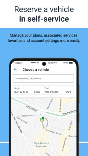
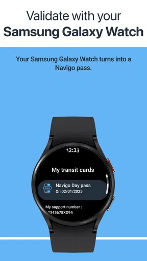
Absolutely. The Île-de-France Mobilités app allows users to purchase various types of tickets directly through the app. This includes single journey tickets, day passes, and other travel cards. Payment is processed securely, and users can store their tickets digitally within the app, making it convenient for daily commutes and occasional travel.
Does the Île-de-France Mobilités app provide real-time transit updates?
Yes, the app provides real-time transit updates, including arrival and departure times, service disruptions, and changes in schedule. This feature is particularly useful for commuters who need to adjust their travel plans on the go. Users can check live updates to ensure they reach their destinations on time, even during peak hours or unexpected delays.
How user-friendly is the Île-de-France Mobilités app for first-time users?
The Île-de-France Mobilités app is designed with a user-friendly interface, making it accessible for first-time users. The app offers intuitive navigation, clear instructions, and easy-to-understand icons. Additionally, it provides a help section with FAQs and support options to assist new users in effectively utilizing all the app's features, ensuring a smooth user experience.


